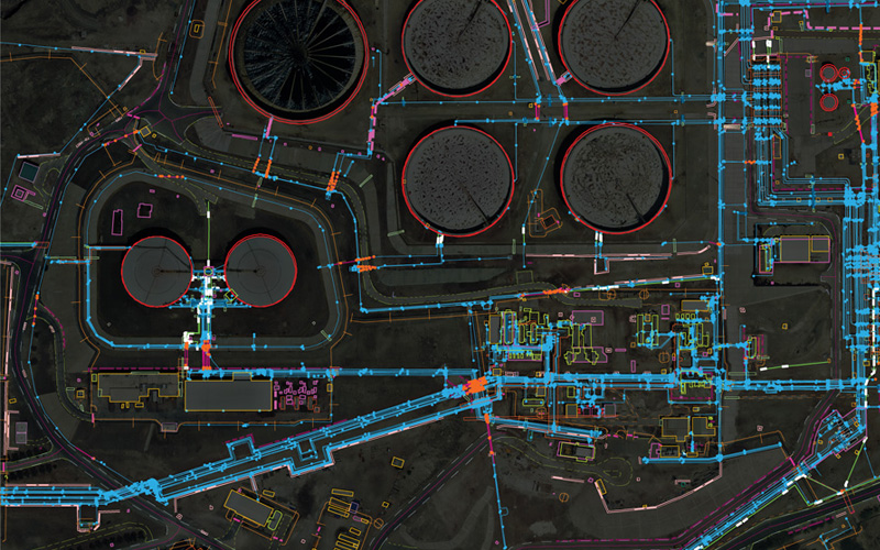
GeoQode provides oil and gas companies services and products that empowers advanced mapping and spatial analytics, increasing operational efficiency through rich location intelligence.
What you should know
Using GIS and Remote sensing oil and gas companies will be able to acquire, analyze, and store data for their sites.
GeoQode provides also inspection services for oil and gas utilities using its own fleet of drones.